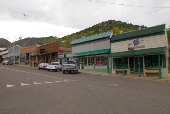
Strolling Amok

Pops goes on tour.

Archive for the category “Tourista!”

Oh, Pioche!

Main Street, and the cafe/bakery on the right dates back to 1907.

Main Street.

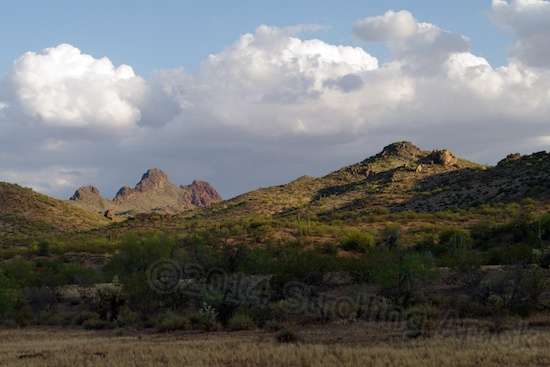
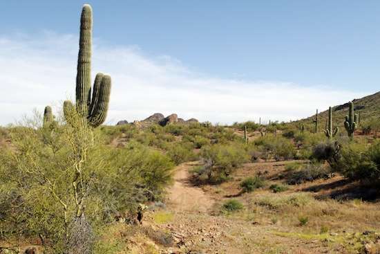
[Caution for data-challenged readers: this post contains a heap of fascinating photos, so don’t click on the “-more-” link unless you’re feeling invincible. The photos are very small, but they do add up.]

If you’re driving about in sprawling suburbia and want a change of pace, like something to readjust your familiar assumptions that the entire world consists of huge malls connected by long strings of badly-timed traffic lights, Pioche is just the cure. I counted just one traffic light in town, and that was a single yellow caution light at one four-way intersection – and that wasn’t blinking because it wasn’t turned on. There’s also one yield sign downtown. Pioche tends to use those instead of stop signs. In the downtown area, unmarked diagonal parking is the rule, and long pickups like the Mighty Furd stick out into the two-lane Main Street, A.K.A. Business Route 93. No matter – cars idle around easily, since traffic here is defined by one or two cars, with nothing in sight in the opposing lane. There are no crosswalks – you saunter where you need to, in order to get where you want to get to.

A mine on the outskirts of town. It's hard for me to imagine the drop, but I've read that they hit water at 2,100' down, and had no practical way to pump it out. Today, it's a question of will and money.

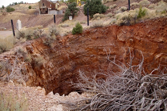
A mine on the outskirts of town. It’s hard for me to imagine the drop, but I’ve read that they hit water at 2,100′ down, and had no practical way to pump it out. Today, it’s a question of will and money.

Pioche pretty much started rolling when silver was found there in 1864. At that time, it was part of the Utah Territory, and when the border with the Nevada Territory was later moved, Pioche came with it. Didn’t matter much, since Pioche remained in the middle of nowhere. Its remoteness attracted opportunists along with the miners. In those days, it was sink or swim. If you could not find a way to put food on the table, Read more…

Silver Island Mountains Loop

Ready, set...

Ready, set…

The Silver Island Mountains are so named because they resemble an island of mountains on an otherwise flat terrain. I don’t use the term “featureless terrain” because the salt flats are on the eastern side, while mud flats are on the western side. The “Scenic Byway” loop, most commonly taken anti-clockwise, heads north, then west, then south around the mountains. The official length of the loop is some 48 miles, though the completion to get back to the same spot (camp) is just short of 52 miles.

Though not breathtakingly high, these mountains are interesting in their features.

Though not breathtakingly high, these mountains are interesting in their features.

Read more…

This is Camping?

Which one is the Defiant? Hard to tell...NOT!

Which one is the Defiant? Hard to tell…NOT!

I made it to Illinois, checking out a new-to-me RV park in Rockford before heading for Plans B or C. Blackhawk Valley Campground is technically the least expensive campsite in the general Chicagoland area, and the most presentable I have yet seen. Nicely kept grounds, full hookups in monthly sites, decent water, if commendably mineralized. And quiet, for the most part. There are occasional dogs barking, but it’s limited since allowing it to persist or having/allowing yer mutt get loose stands a very good chance of getting tossed out and blacklisted. Usage of generators ist verboten, since electricity is readily available. Washrooms and showers are immaculate, and if I don’t feel like paying the cost to electrically heat water in the trailer, a rather luxurious hot shower is available as short walk away.

It's humid here, but the shade trees trim the "extra" heat that direct sun normally adds to the Defiant's interior.

It’s humid here, but the shade trees trim the “extra” heat that direct sun normally adds to the Defiant’s interior.

As a result, this attractive campground is pretty much booked solid. All the seasonal spots are taken up. Upon arrival, I had to Read more…

Mormon Lake Team Roping

The steer roping encampment is right where the Overland Expo used to be. Still a bit moist, but much better.

The steer roping encampment is right where the Overland Expo used to be. Still a bit moist, but much better.

The weekend following the Overland Expo arrived with pleasant surprise – a team roping event! I tripped upon it at the end of its first day, and wandered over to take Day Two in. The nice thing about all these is that none of these things charge any fee to watch. As a competition event with entry fees and payouts, the organizers apparently aren’t about to devote manpower and costs into the few spectators that might also show up. Most all of the people in the stands are related to the competitors, so why bother? I didn’t return on Day Three, Sunday, because of fairly consistent rain all day. Didn’t seem to stop them, though. I could just barely hear the announcer now and then from camp, and toward the end of the day, rousing cheering and whooping from the crowd. I liked that.

Competitors warm up their mounts, and jabber.

Competitors warm up their mounts, and jabber.

Three things in particular struck me. First was the dedication and drive of some of the teams, and many were proud of Read more…

Overland Expo 2015

The local horse riding place had a bunch of horses saddled up and ready, to tempt visitors into going for a ride.

The local horse riding place had a bunch of horses saddled up and ready, to tempt visitors into going for a ride.

[Caution: If you’re on a limited cellular data plan, you might prefer to abort and hold off on this post until you can get to a free WiFi source. It’s a big one, with lots of photos.]

My being out in Arizona’s drier parts for so long made the many days of overcast and frequent sprinkles of rain stand out. The rain actually got significant just before the Expo started, which turned the grounds into a bit of a mudpit, which was probably a first for this show. I felt sorry for the vendors, who had to find the driest spot available in their little preassigned slots to set up canopies that were commonly surrounded by moats of water. Attendees then had to snake their way around the mini-bogs and ponds to navigate a workable path in the gooshy mush. Even on the main paths through the show area, folks needed to use care to pick a path here and there.

I merely cruised around the camping area on my first day, since heavy rains were quickly due in. These visitors from Brazil had a Jeep that we are not offered: one with a diesel engine. Torquey when it counts, Jeep thinks they won't sell here. This one is making its way from coast to coast before moving on to another continent.

I merely cruised around the camping area on my first day, since heavy rains were quickly due in. These visitors from Brazil had a Jeep that we are not offered: one with a diesel engine. Torquey when it counts, Jeep thinks they won’t sell here. This one is making its way from coast to coast before moving on to another continent.

The e-bike proved invaluable here just to gain entry! I was able to idle it right through a couple of deep troughs of water, pedals up, and park it against a perimeter fence or tree to walk at leisure. That was handy, because folks faced congested paths in and through by foot, plus the Aurora carried a big bottle of water for me. People didn’t seem to mind the sloppy ground or resent the occasional Read more…

Grand Canyon Pioneer Cemetery

The entrance to Pioneer Park, erected by the American Legion.

The entrance to Pioneer Park, erected by the John Ivens of the American Legion. and presented in 1928.

[Caution: If you are on a limited cellular data plan, you may want to avoid clicking on “more” to continue reading this post – it’s loaded with medium-resolution photos.]

Easily accessed but seldom discovered, the Pioneer Cemetery in the Grand Canyon National Park is the final resting place for several hundred people – and counting. The first burial took place in 1919, and if a cemetery can be popular, this one is increasingly so. The entry qualification is that you have to have lived at the Canyon for at least three years, and the only way to do that these days is to be employed there. Family members of those already in residence also qualify, as do those who have made a “significant contribution” to the Canyon in some way. At the current rate of four burials per year, it won’t be all that long before current capacity will be reached, and then some difficult decisions made.

On-site, there’s an aura of significance and history on these grounds. What would be a melancholy pursuit in any other burial place is here an absorbing exploration into lives lived, personal identification, and anonymity. The gravestones range from none, to bare unmarked stone, to faded wood, to purposeful simplicity, to charming, and to overworked reflections of our current worship of high tech. The bulk of burials seem to be “recent”, meaning newer than the turn of Read more…

The Canyon Grand

Duck on a Rock. Toward the left is a fat boulder, the top of which has eroded to form a part resembling a duck's bill. It's kind of like cloudgazing, but with a a lot slower change.

Duck on a Rock. Toward the left is a fat boulder, the top of which has eroded to form a part resembling a duck’s bill. It’s kind of like cloudgazing, but with a a lot slower change.

Although I’m now just outside teeny-tiny Mormon Lake Village, AZ, I wanted to show you my last full day in Tusayan. This post represents the first part of it. Possibly due to controlled burning in the park, there was a haze in the air. And I’m told that sunrise and sunset are when the colors really jump out. These are mid-day snaps, with haze. But that’s okay, because there’s just nothing that can capture the sense of space and scale of even this one little part of the Grand Canyon anyway.

You're looking about a mile down here. This is one of the few places on earth where the time it takes to get to the bottom on foot can be just as quickly accomplished as by automobile, simply by using the principle of terminal velocity.

You’re looking about a mile down here. This is one of the few places on earth where the time it takes to get to the bottom on foot can be just as quickly accomplished as by automobile, simply by using the principle of terminal velocity.

These shots are from two roadside stops along the highway that goes along the South Rim. I found it to be an amazing thing to simply pull over, get out, walk a hundred feet, and be at a ledge. Here, there are no railings, no warning signs, and no cautionary tape on the ground. I’ve heard the assertion that Read more…

Tourist Trap Tusayan?

I was astounded to find these in the sandwich shop - candy cigarettes! "Makes you look cool! No lighter required! Hey dad, can I bum a smoke?" And the Maschismo brand says, "Makes you look manly!" On the right, Machismo also offers "Manly Mints".  At $2.99 per 12-pack, that puts these on a cost par with the real thing! I'd assumed these died out in the 1960s.

I was astounded to find these in the sandwich shop – candy cigarettes! “Makes you look cool! No lighter required! Hey dad, can I bum a smoke?” And the Maschismo brand says, “Makes you look manly!” On the right, Machismo also offers “Manly Mints”. At $2.99 per 12-pack, that puts these on a cost par with the real thing! I’d assumed these died out in the 1960s, but though beaten down, I guess Politically Incorrect never dies.

You know, I’ve only been on the road since 2012 and, now that I’ve had to repeat stops, it’s time to point out that not each place I camp in is nirvana on earth. Tusayan, Arizona is one of my favorite places to be. It has its strengths and it has its weaknesses, but they are unusual in that each is toward the end of the scale when compared to many places. Whether the plusses outweigh the minuses is up to how you roll.

Part of the strip that is Tusayan.

Part of the strip that is Tusayan.

Tusayan is one four-lane quarter-mile commercial strip which is a mile or so south of the Grand Canyon National Park entrance on this side. The town caters to tourists who drive and fly in to visit the Grand Canyon’s south rim, and tours are available by

Read more…

Tusayan Trail Ride

Well no, actually, this is Wickenburg, the place I left. I just put this here as a point of reference.

Well no, actually, this is Wickenburg, the place I left. I just put this here as a point of reference.

Busy day, yesterday. I figured I’d do a quick tour around a sizable loop of trails approved for car travel and camping. It turned out to be an 11-mile tour over a mix of soft dirt and rocks, and I couldn’t help but check out several branches heading this way and that. Over that distance, I found 3 or 4 super-secluded, pretty little sites. One is quite close, but does not allow the peculiar E-W aiming that the Defiant needs, nor the sun exposure either. The other sites require true high-clearance vehicles to access and, if it rains at all, four-wheel-drive. Off the main loop, some ruts are so deep that even the Mighty Furd would high-center. For a pop-up truck camper or traditional high-clearance van, the few compact sites scattered about would be very nice places to be. Slow trip to town, though!

Biking down the trail and looking off to the side. Much pleasantry.

Biking down the trail and looking off to the side. Much pleasantry.

I ultimately returned to camp, moved the Defiant over a width to get the solar panels into the sun, and then hung them up to start churning electrons. Nearby tall pines do not the best solar situation make, but since the system is configured fairly aggressively now, it works out fine. The Verizon data signal is good enough that kicking the Wilson amp into gear causes intermittent dropped connections.

There are elk tracks aplenty on the trail here, but I  Read more…

Wickenburg Trail Ride!

I stopped here when it struck me that I never thought I'd have the opportunity to do this kind of thing or see these kinds of sights. But they're out there, waiting.

I stopped here when it struck me that I never thought I’d have the opportunity to do this kind of thing or see these kinds of sights. But they’re out there, waiting.

I sheared off all the storage stuff on the Aurora e-bike the other day, and went out for a ride on a trail leading north. Rather than blather on about it, I’ll just show off the snaps here.

Ditto on this one. You know, you sure don't see much of this in northern Illinois.

Ditto on this one. You know, you sure don’t see much of this in northern Illinois.

Read more…

Post Navigation