
More of a Guide Than a Rule
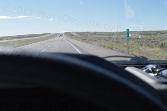
Entering the flat part of New Mexico! Before long, it begins a very gradual but steady climb.
Originally posted 10/20/2012
A guide – that’s my travel itinerary – a fallback if I get boggled and am not sure where to be, when. Looks like it’s gettin’ pretty squirmy, due to today’s realization that there’s some mighty nice places to practice “dispersed camping” right along the way to Quartzite or whatever. Well, maybe not right on I-40, but not too far off.
I started off making a couple of mistakes along the way today, and with the truck’s fuel mileage returning to a more reasonable 11 MPG, I was able to gaze upon what looked like the narrow ribbon of old Route 66 running alongside the Interstate. Made me nostalgic, even though I never rode this section of it in my younger days back in the Pliocene Age.
My first mistake was stopping at the very upscale New Mexico Welcome Center just inside the eastern border of that state. I loaded up on tourist trap pamphlets, among which was one on Tucumcari, my next stop for an overnight. They had photos of the town’s main drag, which is old 66. The images were more eclectic than tantalizing, but still I’m wanting to go see some of it. Then I’ll head west along 66 itself until I hit Cuervo, then get back onto I-40. The photos of derelict gas stations and such were what effectively prompted this time-absorbing diversion. I had been scheduled for McHood Park in Winslow tomorrow night, a heroic 7-hour drive, but some time online produced a ![]() halfway point in Grants, NM at a Wal-Mart parking lot. I can do that, and no one else is here to complain.
halfway point in Grants, NM at a Wal-Mart parking lot. I can do that, and no one else is here to complain.
Then well, see, the Petrified Forest National Park in Arizona is just south of I-40 after that, and I still remember seeing amazing photos of that in a stereo 3D viewer my family had when I was young and innocent. No smart remarks, please. That park is still in business, and it would be awesome to gimp around the real thing and take a look, no? They don’t allow vehicle camping there, but there are two gift shops at the very south end that do, and for free, and for an unlimited time. One of ’em even has 30A power if needed, for 10 bucks. No water or dump stations nearby, though. I’ll have to dig around (and pay) for those each time I dry camp for many days in the middle of nowhere.
If space there allows, it may be the first opportunity I have to see if my solar charging system actually works under load or not. Yup, I still have no idea. That’s what happens when you get the bum’s rush to move your rig – no time to test the system before throwing it into service. Suspense! And hopefully without a speck of drama or adventure, solarly speaking!
So, if I’m going to screw up my schedule by boondocking at the city park in Winslow, it would then be an 8-hour drive to Quartzite. Brutal. Hmmm, I see that 30 miles south of Winslow is one section of the Coconino National Forest called Jack’s Canyon Camping & Climbing Area. It’s claimed to be one of the premier areas of the country for rock climbing. Not for me, but someone else may be there. I own a camera. Plus, it’s free boondocking. I only hope that there’s space to turn the rig around in what is likely more appropriate for truck campers and tents. Google Maps indicates that I’d have a fighting chance, though it may resemble a battleship trying to turn around in a harbor. (Most of the developed, fee-based campsites in the National Forests can’t accommodate my combo, and many of the roads to get to camping areas of any kind are strictly for high-clearance vehicles. The Super Duty, yes, no problem. The travel trailer, no way.)
There are 3 suitable dispersed camping areas near Flagstaff that look mighty tempting, too. Freidlein Prairie, Marshall Lake, and West Clear Creek, the last of which also happens to boast black bears, mountain lions, and javelinas (wild pigs) the size of collies. So, when does a javelina become a wild pig? You know, like the ones in Texas that attack anything around and have to be hunted and shot? Clear Creek is also 60 miles ($24 in fuel) away, making it the least tempting – if the most scenic. Then Flagstaff to Quartzite is a fairly modest drive, I think.
It’s worth mentioning that my cellular-based Internet connection may come apart like a cheap suit whenever I stray too far from the Interstate, whatever “too far” means. Once I leave that park in Winslow, anything goes. I’ll still be writing and photographing, mind you, but you won’t see any changes in this blog until I can get a strong enough signal to upload. That’s not always easy – I started writing this article parked overnight at a McDonald’s, pirating a WiFi signal courtesy of the Desert Inn motel across the street. Then that connection hiccuped and finally died. So much for my hope of watching Netflix on the iPad tonight. But back to topic – I’m assuming that the Quartzite LVTA has some level of cell signal in some sections, but that’s just an assumption based on hope and ignorance. If you decide to leave a comment on any post, note that this delay also applies to when you’ll see it published. All comments are moderated to contain the infernal spammers.
So you see the potential here for unravelling a well-planned schedule, an undoing all based on a desire to take a little while to see a few miles of old Route 66. Pamphlets can be dangerous, I guess.
