Strolling Amok

Pops goes on tour.

Archive for the category “Tourista!”

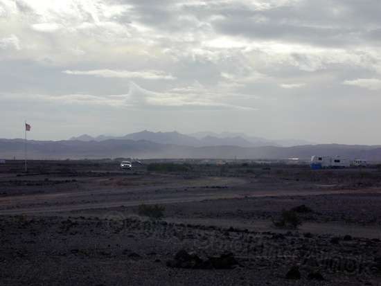
More Imperial Dam LTVA

Well, if you’ve had enough of Imperial Dam LTVA (long-term visitor’s area), prepare to suffer. You see, this huge area offers a commendable amount of options and visuals, and can hardly be covered in a single post attempting to sum it all up in one shot – or three. All I’ll do here is lay out a pile of photos, and explain them with captions.

You've seen vistas, and now, this is the pits - Gravel Pit Road. This lower area offers respite from the wind as well as a relatively miserable cellular signal.

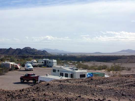
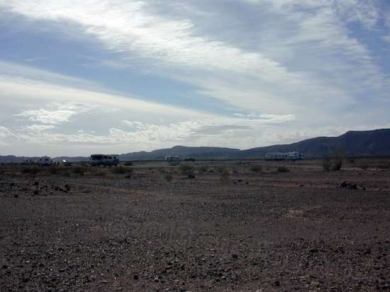
You’ve seen vistas, and now, this is the pits – Gravel Pit Road. This lower area offers respite from the wind as well as a relatively miserable cellular signal.

This is just a reminder that if the scenery doesn't do it for you one day, the sky might.

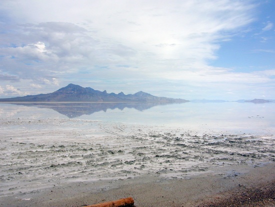
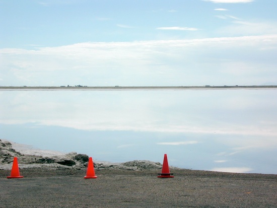
This is just a reminder that if the scenery doesn’t do it for you one day, the sky might.

Read more…

A Look Around the LTVA

A high wind in the late afternoon still brings a beautiful sky, in its own way.

A high wind in the late afternoon still brings a beautiful sky, in its own way.

I’ve been surprisingly busy ever since arriving here to the Imperial Dam LTVA. Much time was consumed scouting for grocery stores that carry what I need, because Yuma is actually huge in layout. I’ve been ordering items online that are not available locally, and it took two trips to Los Algodones, Mexico to get a year’s worth of a prescription that has proven helpful.

An area along Gravel Pit Road is about 30 feet lower, which keeps it out of the wind. But such areas are a no-go for my cellular modem.

An area along Gravel Pit Road is about 30 feet lower, which keeps it out of the wind. But such areas are a no-go for my cellular modem.

Mexico?? Yep, lots of folks head for a couple of towns just across the border for prescriptions and dental work. You yourself might shiver at the idea of either, but the actual results for dental seem to be Read more…

Rainbow Acres Exploration

The hills all around Quartzsite appear to be made up of rubble! Piles of rocks, sand and gravel.

The hills all around Quartzsite appear to be made up of rubble! Piles of rocks, sand and gravel.

The other day I decided to visit the odd, isolated little development I’d seen off in the distance. From far away, the buildings made it look like an industrial area rather than a housing development. I wanted to find out badly enough to spend the one or two gallons of diesel fuel that it would take. So I looped around to the north on paved roads from Quartzsite itself, went west, and then south to get there.

Rainbow Acres.

Rainbow Acres.

Turns out it was a small remnant of a failed housing development called Rainbow Acres. What was there was nicely done, but was only a small fraction of what had been laid out for it. I cruised the streets to find that each lot was ringed with low brick walls. Many were for sale, but at about $70K for a bare lot, these folks apparently were unaware of the housing collapse. This is fairly low land, and washes interrupt the lots here and there to allow storm water to Read more…

Tyson’s Wash Petroglyphs

Tyson's Wash is like the Mississippi in a heavy rain, only not as slow. These rocks were buried in sand two years ago, and became exposed because of turbulence.

Tyson’s Wash is like the Mississippi in a heavy rain, only not as slow. These rocks were buried in sand two years ago, and became exposed because of turbulence.

Tyson’s Wash is a pretty interesting place, being the main water thoroughfare through Quartzsite, AZ. It is mainly a flowing depression of deep sand, and much of it is hundreds of feet wide. Most of the time, it’s parched. But when rains come in sufficient quantity, it is full, and moving fast. I went to see it yesterday while searching out an appropriate campsite with one C. Swankie, an RVer with considerable energy and fortitude. Since she has a degree in archeology, she served as my tour guide while on foot. Her blog is here, and be ready to be amazed by her Bucket List. She’s one of those people – just reading her bucket list makes me feel tired!

The path to get to the petroglyphs was obvious and easy, to a point. Once in the vicinity, a few abrupt washouts made chassis clearance a concern, but 4WD was never needed. Once at the wash, a quick drop-off ended Read more…

The Salt Addicts

This was all lake a week ago.

This was all lake a week ago.

Well, the Top Speed Shootout 2013 is turning into a saga long before it takes place. The most respected and only surviving land speed event this year, it was originally scheduled for September 12th-16th. Heavy thunderstorms flooded it and several other events out as the salt flats went deep underwater. Even as recently as last week, the racing surface looked pretty hopeless. This event’s rain date was October 10-14, and then they decided to arrange with the BLM for October 7-12 due to racer requests. It’s starting to get a bit nippy out here. The BLM okayed that, but then Congressional Republicans nixed that idea by shutting down so many government services. Somehow, the local BLM office is able to restage it with the original 10-14 dates, so, weather Read more…

Cave-In!

Oops!

Oopsie!

Lest you think that nothing goes on when you’re boondocking in the middle of nowhere, apparently nowhere is a happenin’ place! Offered for your consideration is this grader, which was moving dirt from the high ground to slowly fill in the deep void near the roadway when the earth collapsed, tossing the rear end into the ditch. The driver thinks that if it weren’t for the wide blade, it might have gone onto its side. They tried to pull it out forward with another grader that was onsite, but it couldn’t find enough traction on the dirt. So, the driver is now traveling about an hour and a half to get Read more…

A Change of Plan!

Head 'em up, move 'em out! Club organizers give up and break camp...for now.

Head ’em up, move ’em out! Club organizers give up and break camp…for now.

It rained again last night, some 3/4-inches I’m told. The above photo was taken at the Speedway entry point, where club organizers have been camped for longer than I have. The good fortune in this for me was that I arduously biked the sweaty 5-1/2 miles against a headwind to get there just in time. I was out for “a little exercise” and found that the published distance was shorter than reality. Wheeze. If I’d been 2 minutes later, I’d have never been informed by the group that they were giving up for now, but had the flexibility to reschedule again for this coming Thursday Sept 19th. Hey, I can do that! And, I’ll save fuel money by being planted in one spot until the BLM throws me out! From Monday on, it should be nothing but sun, so it has a chance. All this is really funky, because driving past the Great Salt Lake in Salt Lake City showed it to be well on its way to drying up.

You may not be able to see it, but dead center in this picture is the tire they'd originally placed on the shoreline. It's now nearly submerged. That's not good.

You may not be able to see it, but dead center in this picture is the tire they’d originally placed on the shoreline. It’s now nearly submerged. That’s not good.

While I was staying in Marengo, some guy in a biplane was practicing aerobatics overhead nearly every afternoon. Here near Wendover, a couple of fighter jets fly around at a very considerable Read more…

Bonneville Today

Heavy overnight downpours actually made the salt track deeper underwater!

Heavy overnight downpours actually made the salt track deeper underwater!

Well, a couple of overnight thunderstorms with strong winds sure didn’t do the track much good, and with more rain on the way, it doesn’t look good for getting in any runs anytime soon. I like it here though, since the temps have been in the mid-70s and the surrounding area is certainly nice enough on its own. I’m told that it’s normally much hotter this time of year, but I assume that the consistent cloud cover has had its effect.

In the distance is I-80, with the "track" being closer in. It's under about 8 inches of water.

In the distance is I-80, with the “track” being closer in. It’s under about 8 inches of water.

Today was errand day for fly paper, laundry and a minor food shop, but I also explored some back roads in the F-250 before I did anything else. I held the errands off for a day because I’d called the sole local hardware store and found that flypaper was out of stock but expected at the end of the day. I dived off the paved route at a dirt path labeled a “Scenic Byway”. Having virtually no traffic, it was smooth dirt with a few rocks, except for a few washes that crossed it. One was especially deep, and with the recent rain, I got out and made sure Read more…

Green River, Wyoming

Driving in Wyoming can visually be as good as it gets.

Driving in Wyoming can visually be as good as it gets.

I was a little iffy on stopping at Wild Horse Canyon Road in Green River, Wyoming because the description I’d read was, “Steep but manageable climb. IT IS MUDDY AND SLIPPERY WHEN WET!!!” I’d been driving through intermittent rain all the way there today, naturally. I can tell you, it doesn’t take much of a grade with a 7,000-pound trailer to make a pickup truck’s rear tires get unhappy as they try to move a combined 16,000 pounds on sand or gravel. If conditions looked bad, I had a rather boring Plan B stop in Little America’s parking lot.

This is near Sweetwater, Wy. It's hard for me to take these traveling views for granted.

This is near Sweetwater, Wy. It’s hard for me to take these traveling views for granted.

Fortunately for me, the last 20 miles seemed to clear away the rain. The exit I needed was closed for a rebuild, so I got off early and the GPS easily got me to Wild Horse Canyon Road. It’s mostly hardpack dirt, with some areas graveled over. The dirt looked like clay, which really Read more…

Parting Shots

An overcast morning view out the dining table window.

An overcast morning view out the dining table window.

In taking the half hour to wobble down the washboard road, I took some time to stop and take a few more pictures in Medicine Bow National Forest:

What gets me about this place is the nature of the rocks. They often look stacked.

What gets me about this place is the nature of the rocks. They often look stacked.

Read more…

Post Navigation